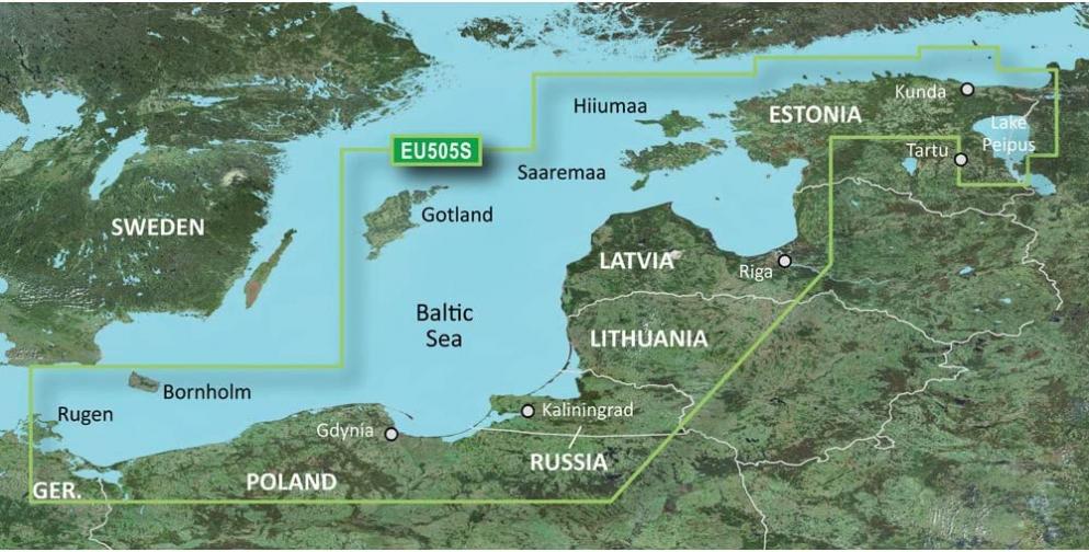

Garmin Bluechart G2 – HXEU505S – Baltic Sea East Coast – MicroSD/SD
$22.40
PRODUCTS DESCRIPTION
|
HEU465S Covers: Detailed coverage from Bermeo, Spain to St. Nazaire, France including La Rochelle, Cap Ferret, and La Gironde. 3-D View: Yes. Aerial Photos: Yes. Card Format: Garmin Data Card. Port Plans: Yes. Box Dimensions: 1"H x 4"W x 4"L. Weight: 0.1lbs. This item is non returnable . Features & detailsFeatures
Product information
Additional Information |
RELATED PRODUCTS