|
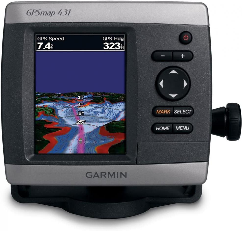
The Garmin GPSMAP 431 Compact Chartplotter with U.S. Inland Lake Maps features an ultra-bright 4 inch QVGA color display along with an improved high-speed digital design for increased map drawing and panning speeds. It''s ready to go with a built-in, satellite-enhanced basemap preloaded with U.S. Inland Lakes and an easy-to-use interface designed to help you navigate the open waters with ease. This unit also accepts BlueChart g2 Vision cards for added features and functionality such as high-resolution satellite imagery, 3D views and Auto Guidance technology. Features & details Features - Preloaded with U.S. inland lake data
- High sensitivity GPS receiver
- 240 x 320 pizels QVGA color display
- Waterproof (IPX7)
- NMEA 0183 compatible
- GARMIN GPSMAP 431 GPS CHART PLOTTER INLAND LAKES & RIVERS
- Internal/External Antenna = Internal | Resolution (VxH) = 240 x 320 | Screen Size = 4.0/3.2 x 2.4 | Screen Type = Color |
- Touchscreen = No | Waterproof Rating = Waterproof | Waypoints/Routes = 3,000/100 | Weather Capable = NONE | Cartography Type = NONE |
Product information | Item Weight |
1.3 pounds | | Product Dimensions |
5 x 2.7 x 5.7 inches | | Item model number |
010-00765-00 | | Batteries |
2 AA batteries required. | | Is Discontinued By Manufacturer |
No | | Warranty |
1-year limited parts and labor | | Are Batteries Included |
No | Additional Information - ASIN: B002KR1J06
- Customer Reviews: 4.0 out of 5 stars 6Reviews
-
Best Sellers Rank:
#1,086,525 in Electronics (See Top 100 in Electronics)
#994 in Marine GPS Units & Chartplotters
-
- Date First Available: September 14, 2004
|